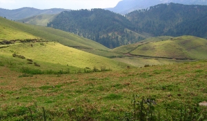
Believe it or not, something perceived as insignificant as the type of grass around a water body can determine the kinds of organisms that live in and around it. The air we breathe, the water we drink, the food we eat and the clothes we wear are all derived from nature and the complex processes that take place to sustain life on earth. That, my readers, is the whole concept of biodiversity (how diverse our ecosystem is).
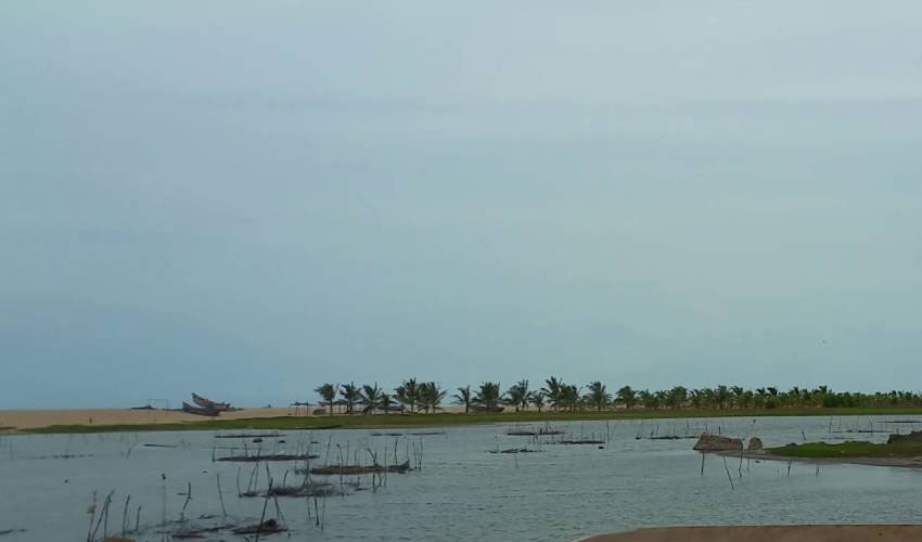
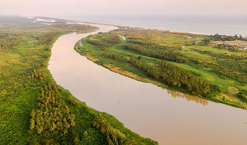
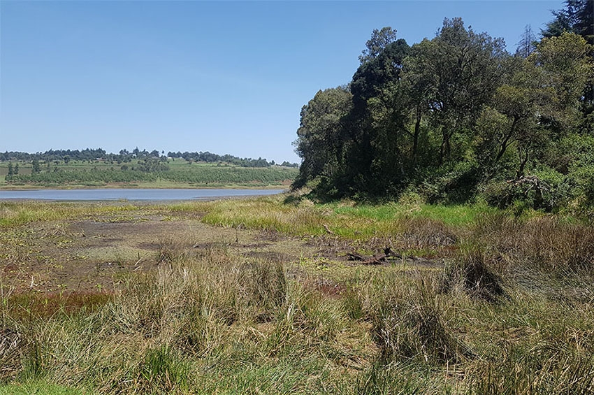
The ecosystem is comprised of several types, of which the aquatic environment is a part, and within the aquatic ecosystem are resources such as wetlands, lakes, rivers, freshwater and marine habitats. Wetlands are areas of marsh, fen, peat land or water, whether natural or artificial, permanent or temporary, with water that is static or flowing, fresh, brackish or salty [2]. The Keta lagoon doesn’t fall short of these characteristics as it is an extensive, brackish water-body, with a depth and saltiness conducive for certain organisms to thrive. These features support a diverse array of plants and animals of immense importance to the productivity of the wetland.
Characteristics of the Lagoon
A wetland such as the Keta lagoon is considered internationally important if it meets the criteria outlined in the Convention on Wetlands [3]. Ghana is blessed with eight such wetland sites along its coast, namely Esiama, Elmina, Muni, Densu Floodplains, Korle, Sakumo II, Songhor and Keta Lagoons. These wetlands have been earmarked as internationally important wetlands due to the total populations and species of waterbirds they support [1] and also based on the nine characteristics mentioned in the Convention on Wetlands.
Out of the eight wetland sites, through the Ramsar Convention in 1988 five were finally designated as Ramsar sites in 1992 [4]. These five were the Keta lagoon complex, Songor, Sakumo, Densu delta and Muni lagoons. The Keta lagoon is the largest among them. First of all, let us understand why they are called Ramsar sites. In 1971, a UNESCO convention called the Convention on Wetlands of International Importance for the Conservation and Sustainable use of Wetlands was signed in the Iranian city of Ramsar, thereby acquiring the name Ramsar Convention and the designated wetlands have come to be known as Ramsar sites.
Importance
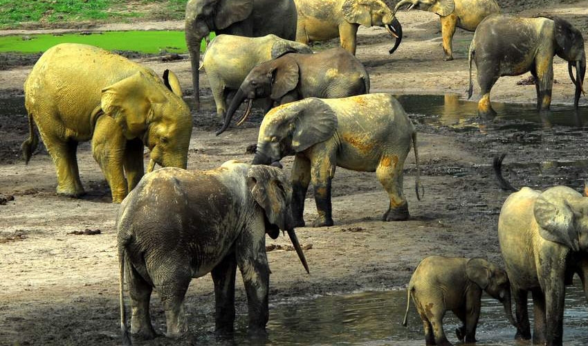
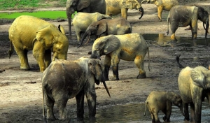
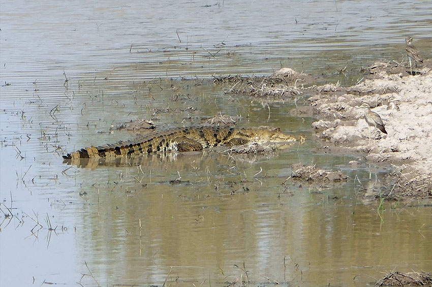
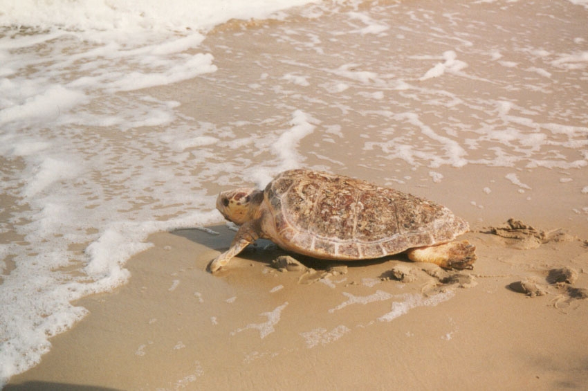
Now that we understand what a wetland is and why some wetlands are called Ramsar sites, let me give you an idea of just how important the Keta lagoon is. The population of plants and animals the lagoon supports does not only impact on biodiversity but are of economic importance to the inhabitants of the Keta community whose primary aim is to make a living. The dominant vegetation includes swamps, scrublands, and mangrove forests, which are heavily exploited by resident communities for fuel and commercial fishing. The site provides safe nesting grounds for certain threatened species of sea turtle, leatherback turtle, the green turtle, and it is particularly important for the Nile monitor and the vulnerable West African Manatee. It is considered the most important coastal wetland for birds in Ghana, and supports over 72 resident and migratory bird species [5].
I remember being part of the wildlife club back in primary school and had the opportunity to embark on a bird watching expedition. It was remarkable to watch these rare birds at sunrise.
All wetlands are beneficial in many ways. The benefits include a range of wetland functions, products and attributes. In terms of function, wetlands provide a source of water storage, flood prevention, groundwater recharge and discharge, retention of nutrients and stabilization of local climatic conditions, particularly rainfall and temperature. Products generated by the lagoon include: wildlife, fisheries, forest, forage and agricultural resources. Biological diversity and unique cultural and heritage features are some of the attributes of the lagoon. The combination of the functions, products and attributes gives the lagoon benefits and values that make it important to society [6].
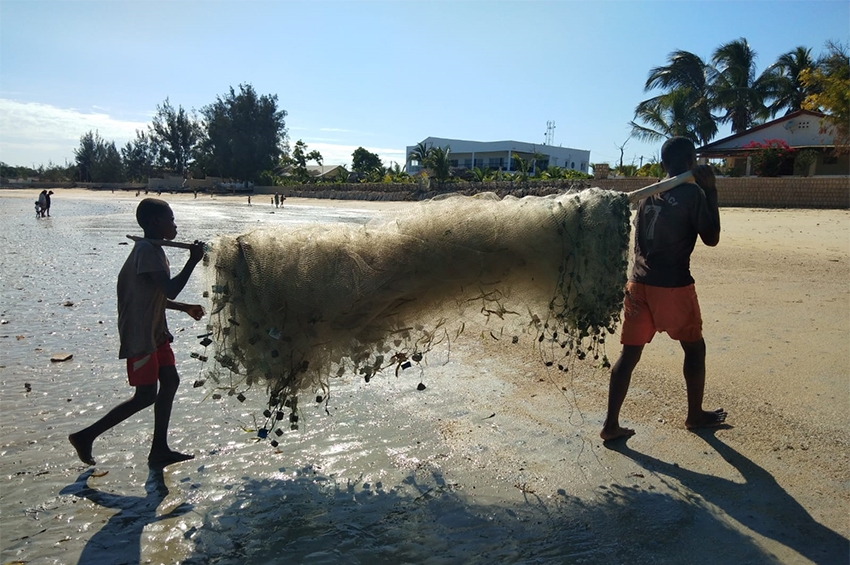
The Keta municipality is inhabited by 147,618 people. The vast land mass area of 1,086km2, including the 12km wide and 32km long Keta lagoon and its resources serves as a source of livelihood for the community and its surroundings [7]. Fishing and vegetable farming remain the dominant occupations among the inhabitants. Keta is a known destination for wood harvesting (for charcoal) and craft making [7]. The lagoon is also economically exploited for the production of salt [8]. Shallot farming [9] and petty trading are other economic activities that sustain the inhabitants of the Keta municipality.
Management
In terms of management efforts, Ghana was one of the four countries that signed the instrument of ratification which brought the African Convention on the Conservation of Nature and Natural Resources into force in 1969. Ghana is also a signatory to the Convention on International Trade in Endangered Species of Wild Fauna and Flora (CITES) and the Convention on Wetlands of International Importance especially as Waterfowl Habitat [11].
Way before conventions like CITES, our forefathers made numerous traditional conservation efforts. In Ghana, there are locally protected areas such as sacred groves (e.g. Tafi-Atome Monkey Sanctuary) and other community initiatives (e.g. Mount Afadjato Community Forest Project) which contribute significantly to biodiversity conservation. Unfortunately, even though the traditional authorities play a critical role in in-situ conservation, no provisions have been made to formally accord them legal recognition and to include them in the conventional management regime of the country [11]. As far as traditional leadership goes, at a community level, there are days which have been set aside as taboo non-fishing days, indirectly helping to curb over-fishing. Such practices are usually observed on Tuesdays in many communities including Keta [12].
Challenges
Unfortunately, many activities have led to the deterioration of the Ramsar site either through poor conservation methods, or natural or anthropogenic disasters. For instance, following the construction of the Akosombo dam in 1961, the rippling effects experienced by the low-lying lands of the Keta area specifically the eastern side were wave action, sea level rise and lagoon water rise. These led to persistent coastal erosion which is now one of the major challenges faced in the area. The Todzie River fills neighbouring Avu lagoon during wet periods and subsequently overflows into the Keta Lagoon via several small tributaries such as the Aka and Kplipka streams from the north. The natural drainage pattern of the Keta lagoon has been affected by the construction of the Akosombo dam in a cascading manner in that, the dam, which is located upstream of the Volta River has led to silting and blockage of the channels that interconnect the lagoons [13].
Reduction in fishing activities in the lagoon is another dire consequence of the construction of the Akosombo Dam. The Keta lagoon has become more and more brackish over the past years due to prevention of flooding of the Volta River. Thus the Keta Lagoon does not receive waters from the Volta River, resulting in large salt production at the peripheries. On a brighter side, this explains the lucrative source of livelihood through salt mining for the Keta inhabitants.
Rising sea levels have also led to severe erosion in Ghana’s coastal villages. The extent of the erosion is visible in the alarming rate at which hitherto thriving coastal fishing communities in the Keta Municipality are rapidly being washed away by marauding sea waves. Fuveme is one such community, which has become literally inaccessible without the use of a boat. Residents say, that the community was a few years ago about 5km away from the coast but now merely a few metres. The entire Keta Municipality is heavily hit by erosion and is estimated to be the place most hit by erosion in the whole of Ghana. The government of Ghana initiated the Keta Sea defence wall to protect the communities along the Keta coast.
Even though this measure is one sure way to curtail the increasing coastal erosion, it's overly expensive nature makes it unsuitable for the entire coastline. For instance, it was estimated, that an amount of $90 million is needed for the construction of every 10km of the defence wall. As a result of the hefty financial implication on a developing economy like Ghana, only three communities have been covered by the defence wall built at a cost of $52 million [14]. Aside the above, a living shoreline will help curtail the incidence of coastal erosion along the Keta lagoon. This can be done by planting of seaweed and thereby creating an environment that attracts sea creatures - with more life comes less erosion and subsequently restoration. Wind breaks will also be a great way to mitigate the force of erosion along the Keta lagoon, thus restoring the lagoon ecosystem.
There has been a reduction in land for agriculture, reduced soil fertility, consequently affecting yields and loss of coconut plantations [7]. These challenges have had an impact on job opportunities in the area. The lack of varied employment has pushed many people from the communities surrounding the lagoon into fishing for a living, resulting in intense fishing pressure and this has led to reduced fish catch, as well a reduction in waterbirds, possibly due to the hunting or trapping for game for domestic consumption. Waterbirds serve as indicators of environmental quality by their presence, abundance and diversity, [15]. By their reduction in number, this could lead to an imbalance of other organisms involved in the food web. The Keta lagoon has been cited as the most important wetland for waterbirds on Ghana’s Coast and forth most important waterbird site on the Gulf of Guinea Coast [16] together with Songor Lagoon. The site supported over 100,000 birds including waders, egret species, Himantopus species, etc. however, due to the incessant erosion in the area, this has clearly had a negative effect on the vegetation and fauna which together make the Keta lagoon habitable by these waterbirds which are migratory, thus contributing to their dwindling numbers and thus altering the biodiversity of the entire lagoon.
An interview with Collins Ameho (an inhabitant of the Keta community) revealed that, the community faces many other challenges. According to Collins, one of the challenges is siltation in the lagoon. Apparently, due to this, the lagoon was dug out some years back and the sand was used to fill certain parts of the community, creating a township by the lagoon. “This left a deep trench in a portion of the lagoon which has now become a dangerous place to venture for fear of drowning”. Apparently, there have been some demarcations in the lagoon and some areas have been mapped for oil drilling and in mapping out the lagoon, trawlers dredge out some weeds around the lagoon causing fishes that hide in these weeds during spawning, to migrate, “thus fishing hasn’t been lucrative” [17]. Although oil drilling is yet to begin on the Keta lagoon, incidents in other areas such as the Niger Delta suggest imminent destruction to the ecosystem through inevitable and ill-managed oil spillages for instance. Not to mention organized crime by residents by reason of unfulfilled corporate social responsibilities of oil-drilling corporations which have usually led to communal dislocations in parts of Africa.
Keta Lagoon was once known for its thriving shrimp fishery as a result of the abundance of two particular species of shrimp Penaeus duorarum and Parapenaeopsis atlantica [18]. The Kedzi canal was responsible for the successful migration of these juvenile shrimps from the sea into the lagoon. Upon maturity, the adults were captured in the lagoon or during their migration back to sea. The flourishing shrimp fishery in the Keta Lagoon came to a halt after the closure of the canal by the then Public Works Department and the sand barriers of the sea. Destruction of the canal by natural and man-made forces has negatively affected the socio-economic status of the inhabitants as the source of livelihood through shrimp farming no longer exists. Although the canal was closed in order to reconnect a trunk road from Denu to Keta, I believe restoration of the Kedzi canal will vamp up fishing and trading activities which are the major sources of livelihood in the Keta area.
Interventions
Inhabitants of the community also revealed, that the District Assembly makes a constant effort to sensitize the inhabitants about the methods of fish harvesting and future implications. They added that the Wildlife Division ensures the conservation of the lagoon by ensuring strict adherence to practices that prevent the destruction of plants and animals of importance. In doing so, the lagoon itself is protected.
In the past, several other projects and interventions have been made towards, restoring the integrity of the lagoon and its resources; such as increasing sustainable vegetable production in the area. Another example of such a project is the “Regeneration, Sustainable Use and Management of Mangrove in the Keta Lagoon Complex Ramsar Site”. This project focused on the degraded lagoon due to mangrove over-harvesting, with subsequent negative impacts on fishing resources and the turtles’ breeding grounds [19]. Previously, there was no centralized body to deal with issues on sustainable use of mangroves in Ghana. Young mangrove vegetation of Rhizophora and Avicennia species scattered along the banks of the Keta lagoon, were cut down for fishing by community folks within the mangrove areas. This activity was known as the Acadja system [20] which was a threat to mangroves.
However, with the successful intervention of the sustainable use and management of mangroves project, this activity has been addressed although another socio-economic intervention aimed at improving the lives of the Keta inhabitants such as vegetable farming threatens the mangrove project. In areas where there is no sign of mangrove cutting, the presence of a vegetable farm is seen as a future threat as expansion of vegetable farms would mean conversion of mangrove lands into agricultural lands. Thus, even though the vegetable project is a positive intervention, to a certain extent, it has undulating effects and dire consequences to other sectors.
The Save the Seashore Birds Project- Ghana (SSBP-G) is also an intervention project which had the objective of changing the attitude of many Ghanaians towards wildlife, especially waterbirds, through education, public awareness and training [1]. This intervention was very successful at conserving seashore birds and their coastal wetland habitats in Ghana to the extent of reviving the then dormant Ghana Wildlife Society when the project ended [21]. All these were done in order to conserve the biodiversity of the Ramsar site.
In situations where in-situ conservation alone cannot secure the survival of the target species, ex-situ or off-site conservation interventions, such as Kumasi Zoo or Aburi Botanical Garden, are used as a last resort. Protected areas have been created with the purpose of ensuring that representative samples of the various ecological zones are set aside to facilitate in-situ conservation in Ghana [11]. The management of Ramsar Sites is interdisciplinary and usually, blends well with tourism.
Have you ever been to the Kumasi zoo or the Aburi botanical gardens? Next time you visit such places, remember that they are not just tourist attraction sites, but also off-site conservation establishments.
The present state of the lagoon
An inhabitant laments that the state of the lagoon for the past five years, hasn’t been good. “One can no longer get the resources they used to get from the lagoon, thus, people have resorted to using dynamites and cyanide to fish in recent times”. Local authorities such as chiefs and local government bodies have warned against these practices. Other issues such as illegal fishing gear and fish net size have been hot topics in the municipality. The chiefs go as far as on radio (Radio Jubilee, he emphasized) to educate the community on these issues. Collins adds, that sometimes water levels recede and at times, it overflows its boundaries and this isn’t just a result of the climate but due to receiving waters from River “Toji” in Upper Volta, and the Bagre Dam in neighboring Burkina Faso. Fish used to be in abundance because fishing was done with rudimentary gear in the past, but now, due to the frequency of fishing and the catching of fingerlings alongside mature fish, fish catch has reduced.
Conclusion
The pivotal role relevant state agencies play in the area of conservation cannot be over emphasized. Their role would be incomplete in the drive towards conservation if the ordinary citizen holds back on their role. Thus the onus lies on you and me to do our part in conserving the biodiversity of sites like the Keta lagoon and many others. Remember to get involved in biodiversity conservation on International Day for Biological Diversity on May 22 every year.
References
Lamptey A. M., and Ofori-Danson, P. K. (2014) Review of the Distribution Of Waterbirds In Two Tropical Coastal Ramsar Lagoons In Ghana, West Africa. West African Journal of Applied Ecology, vol. 22(1), 2014: 77–91.
UNESCO. (1994). Convention on Wetlands of International Importance especially as Waterfowl Habitat. Paris
Convention on Wetlands, Ramsar, Iran, 1971
Addo, C., Ofori-Danson, K. P., Mensah A., and Takyi, R. (2014). The Fisheries And Primary Productivity Of The Keta Lagoon. World Journal of Biological Research Vol.6 :(1 ), 2014
Ramsar Sites Information Service (2015). viewed 13 December 2018 https://www.ramsar.org/sites-countries/the-ramsar-sites
Finlayson CM, Gordon C, Ntiamoa-Baidu Y, Tumbulto J and Storrs, M. (2000). The Hydrobiology of the Keta and Songor Lagoons: Implications for coastal wetland management in Ghana. Supervising Scientist Report 152, Supervising Scientist, Darwin.
World Bank. (2018). Fighting coastal erosion in Keta area (English). West Africa Coastal Areas Management Program; case study no. 6. Washington, D.C.: World Bank Group.
Wiegleb, V. (2016). A Literature Review on Wetlands in Accra. WaterPower Working Paper, No. 5. Governance and Sustainability Lab. Trier
Economic activities in the keta lagoon. Viewed 20 December, 2018. www.ghanaexpeditions.com › Home › Wildlife and Nature Reserves
Frans Lanting Qoutes, viewed, 27 December, 2018. https://www.brainyquote.com/quotes/frans_lanting_555261?src=t_biodiversity
National Biodiversity Strategy And Action Plan For Ghana (2014).
Kombat, E. O., Ameyaw, G. A., Asiedu, B., Amadu, A. A., and Solomon, N. J. (2017). Analysis of Adverse Impacts of Capacity Reduction Strategies on the Livelihoods of Smallholder Fishers in Ghana.
BirdLife International (2019) Important Bird Area factsheet: Keta Lagoon Ramsar Site. Downloaded from http://www.birdlife.org on 21/07/2019.
www.bbc.com/news/world-africa-36257360
Dankwa, H.R., Shenker, J.M., Lin, J., Ofori-Danson, P.K and Ntiamoabaidu, Y. (2004). Fisheries of Two Tropical Lagoons In Ghana, West Africa. Fisheries Management And Ecology 11: 379 – 386
wikipedia.com (2019) Keta lagoon Downloaded from http://en.m.wikipedia.org/wiki/Keta_Lagoon
- Ameho. 27th December 2018, pers. comm.
FAO PART I. STATUS OF COASTAL AQUACULTURE IN AFRICA http://www.fao.org/3/ad794b/AD794B02.htm
Bojang (2009). The Relevance of Mangrove Forests to African L Fisheries, Wildlife and Water Resources. Nature & Fauna Volume 24, Issue 1. Food and Agriculture Organization of the United Nations, Accra, Ghana 2009.
F.K.E. Nunoo and A. Agyekumhene. 2014. “Mangrove Cultivation and Management in Ghana: Issues and Options Report”. Improved Fish Smoking Project, Renewable Energy Sector, SNV Ghana.
GWS - https://www.ghanawildlifesociety.org/about/company-history